Grab Your 3-D Goggles
- Nov 10, 2019
- 2 min read
Updated: Nov 11, 2019
I am working with a talented cast of characters on a 3-year COMT project. One outcome of this project will be for NCSU's Ocean Observing and Modeling Group's "ocean weather" forecast to be available to folks like the National Weather Service (NWS) during a storm event.
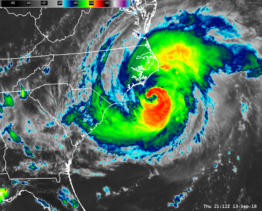


Hurricane Florence (on left). Tampa FL NWS Weather Forecast Office (on right).
There are already many valuable forecast models which predict winds, waves, and flooding, such as the ADCIRC model. But these are all surface forecasts, and NCSU provides something new: details through the entire water column, from top to bottom. How is this useful? That's where Second Creek comes in.
Second Creek and SECOORA will soon visit stakeholders to pin down exactly how users might access such a vast amount of 3-dimensional forecast data. In addition to weather forecasters at the NWS, aquaculture (e.g. oyster farms and fisheries) and National Audubon Society managers have their own marine animals and ecosystems to protect.


Jay Styron and SECOORA RCOOS Manager Jennifer Dorton (not pictured) tend to their oyster farm (on left). A flock of American Oystercatchers on Shellbed Island, courtesy NC Audubon (on right).
It will be a challenge to strike the balance between offering unfiltered access to the entire forecast and creating prepackaged views that may be more useful to consumers on the go. Fortunately, we aren't starting from scratch.
SECOORA has an impressive network of professionals already engaged in this process and many more to bring into the fold. Second Creek may find that "skinning" the Marine Weather Portal to focus on specific coastal areas will be a good place to start.

A screenshot of the SECOORA Marine Weather Portal.
We are excited to have this opportunity to create something that will really make a difference to help "protect life and property" where life includes animals with hair, feathers, and fins.
Comments